GPS Fields Area Measure Tool - Measure Any Area and Distance
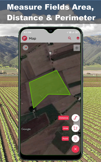
The best way to measure any area and distance is using your phone's built-in GPS to determine your location.
In order to make it more useful to the user, we have introduced the concept of manual mode. In manual mode, the user can manually place the points and measure the distance using the calculator. To save the user's time and efforts, the app provides the option to auto-measure the area in the manual mode. The user will just have to select the option to auto-measure.
By the way, the distance to measure is calculated based on the location of the points selected by the user and not the location of the actual points. Therefore, the distance values are approximate and depend on the accuracy of the phone's GPS.
By default, the app uses the GPS and maps of the Android platform. However, this does not mean that it is limited to Android. It can also be used with any GPS-enabled device.
Note that some devices do not have the GPS sensor. In this case, the app can use the compass sensor.